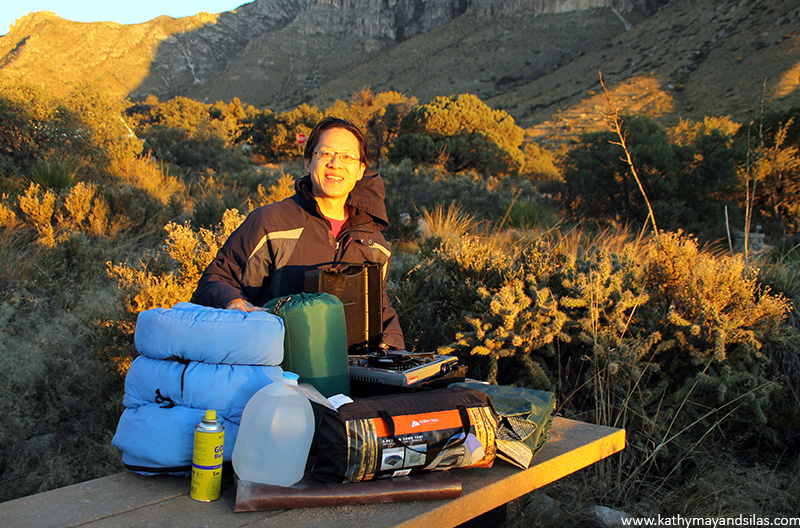
The backdrop of Spiral Jetty is absolutely alien! Looking towards the land, we saw massive basalt boulders left behind by an extinct volcano lying amongst puffs of yellow-green brush and scrub. Then the shore abruptly transformed into a tundra of salt, with a surface that cracked and fragmented under our feet. Eventually, the ground became lattices of crystalline deposits, with miniature salty pyramids atop. In the distance, the waters of the Great Salt Lake appeared reddish, a hue caused by the abundance of microbes.
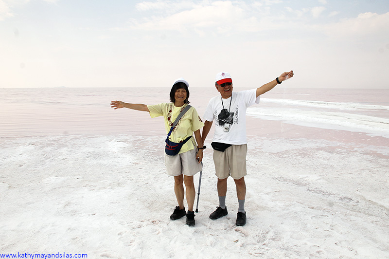
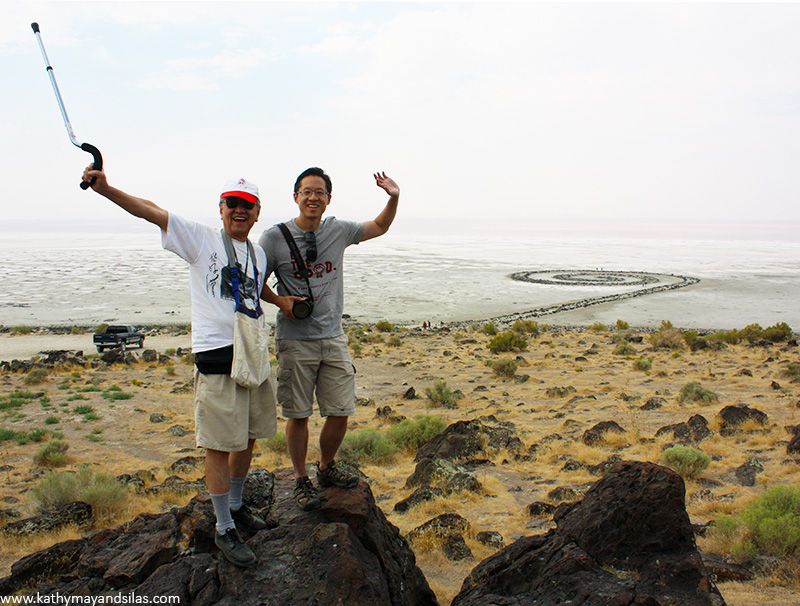
In making Spiral Jetty, Smithson and his crew (two dump trucks, a tractor, and a front loader) displaced 6,650 tons of mud, salt crystals, and basalt rocks from the shore, strategically repositioning the earth and rock into the interactive curvy structure it is today. From a distance, the design is awesome (see it on Google Maps). From our point of view, the scale was impressive. Spiral Jetty is 15ft wide and 1,500ft long, and we were dwarfed in comparison.
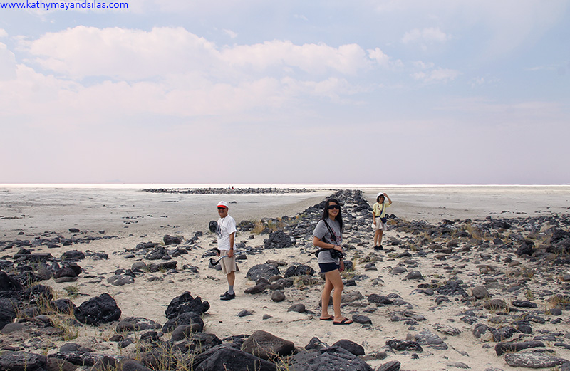
A core tenet of land art is its susceptibility to the cycles of nature. In 1970 when Spiral Jetty was created, water levels of the Great Salt Lake were particularly low. In 1972, it became submerged and remained that way for 30 years, except for rare and brief appearances. However, in 2002, severe droughts caused the lake to recede and Spiral Jetty has remained visible since. We wonder what Spiral Jetty will look like when you visit. Let us know in the Comments section below!
Until next time,
Kathy May and Silas
]]>
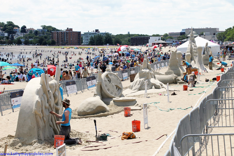
The fifteen master sculptors from nine countries (only three American) collaborated on the centerpiece sculpture which, according to the festival’s theme of “celebrating literacy,” depicted classic literary works throughout the generations. You can see it above in the cover image of this blog post. How many allusions to our favorite childhood books can you spot?
Sand art at the festival was not just collaborative, however: It was a competition with a massive cash prize! Over three days, each artist had 24 hours to transform ten tons of sand into a magnificent sculpture within an 18’x18′ area. The sand used in the festival was not ordinary Bostonian beach sand. Over 350 tons of special granite sand were hauled in from Hudson, New Hampshire! Reportedly this particular sand is a favorite medium for these specialized artists, because the texture is ideal and the strength is strong for stand-alone sculptures.
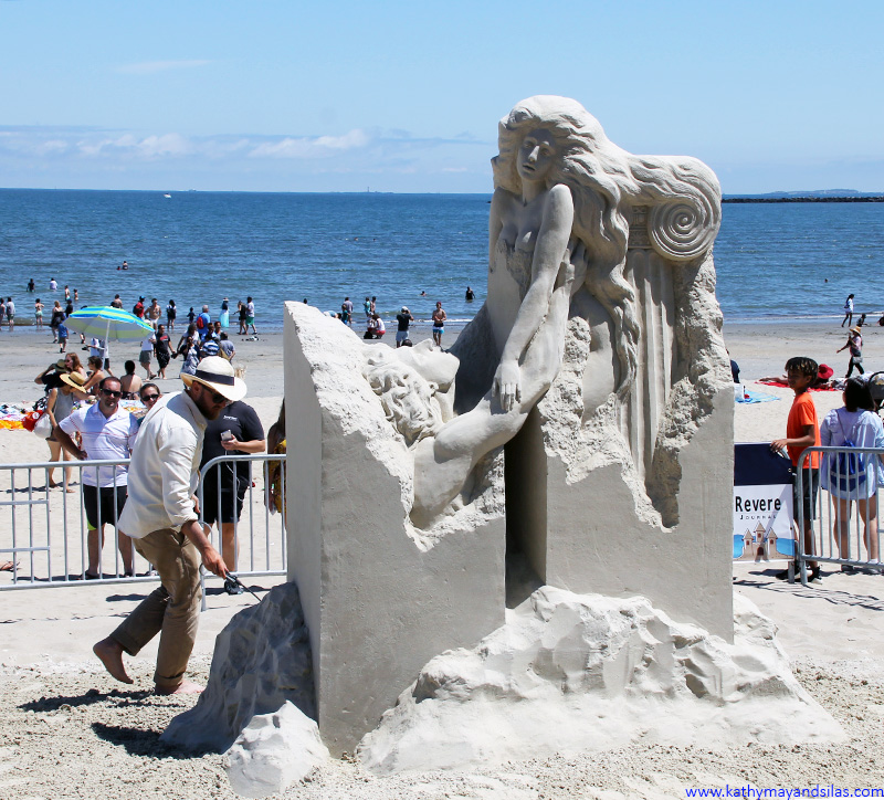
The pieces were judged on degree of difficulty, originality and creativity, quality of sculpting, and overall visual impact. The 1st Place Winner was “Vanishing Muse” by Pavel Mylnikov from Moscow, Russia. This was his fourth time competing at Revere Beach, and he also was last year’s winner!
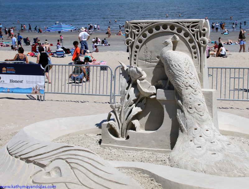
There were a number of marvelous sculptures otherwise, and the public was invited to vote for their favorite. “A Nouveau Love,” created by English artist Rachel Stubbs won the People’s Choice Winner. It was also the judges’ selection for 5th Place Winner!
Click on the photo album below to see some more sand sculptures. Next July, don’t miss the 2019 International Sand-Sculpting Festival! It’s fun, free, and sure to be a fantastic day! We’ll see you on the beach!
Until next time,
Kathy May and Silas

SHELTER
Not surprisingly, the first thing that comes to mind when one thinks of camping is a tent! Tents are classified by size, material, weight, weather durability, etc. They range from cozy single occupancy to multi-room structures with several entrances. Below are some basic types of tents. Additionally, consider a tarp: While the tent is very important, the tarp is too. Although not particularly a necessity, tarps can protect the tent from tears by rocks and rough terrain below, and also from wet and soggy ground. 
 Dome tent: The dome tent (A) is the most popular type of tent for casual campers. Two to three curved poles intersect at their centers to support this tent. Dome tents are free-standing structures that can be picked up and moved versus staked down. They provide plenty of head room compared to the footprint.
- Hoop tent: Similarly to the dome tent, the curved structure of the hoop tent (B) allows precipitation to slide off of the tent. Hoop tents consist of arches of poles arranged in series.
- A-frame tent: The A-frame tent (C) is simple and classic. A single horizontal ridge pole is supported by two poles on each side that meet at an apex. A-frame tents are less roomy because of the steep sloping sides.
The forecasts for our desert destinations called for a whopping 0.5” rain per month so we anticipated little need to shelter from rain, sleet, or snow. We purchased a three-person tent which is ample room for just the two of us, our equipment, plus Mimi when she joins us on future trips. We also opted for a heavy-duty polyethylene tarp similar to what we use on the Habitat for Humanity construction sites. While ground moisture was less of a concern for the present trip, the tarp protected from rocks that may cut the tent.
SLEEP
When it comes to staying warm, the sleep system is one of the most important factors of camping. We prioritized this for two reasons: Firstly, the desert’s lack of humidity prevents retention of heat radiating from the ground after the sun goes down; this means that it gets cold at night! Secondly, Kathy May is always cold no matter what! Thanks to the warm sleeping bags from Silas’ parents and from Kathy May’s medical school friend, Sam, we were able to save a few dollars for this trip. We did, however, investigate sleeping pads. These are certainly not a necessity; however, they’re not exactly a luxury either, especially on camping trips that are days-long. Look for the “R-value” which denotes insulating capacity. In addition to providing warmth, sleeping pads also ensure better rest and comfort, a reward after days of grueling hikes and exhausting travel.

- Air: Inflating sleeping pads (A) are the most comfortable of camping sleeping pads. Some disadvantages include poor insulation, need to pump or blow up, and, most of all, propensity for puncture and leakage. Camping mattresses (B) are hybridized with air mattresses. Creative alternatives include pool rafts or floats; interestingly, many inflatable sleeping pads are advertised to double as flotation cushions!
- Self-inflating: To use a self-inflating pad (C), roll it out, open the one-way valve, allow air to enter, and then close the valve. These are not as thick as air pads and are therefore less comfortable; however, they are more compact and light.
- Closed-cell foam: This dense material is designed to prioritize insulation over comfort. They are no-nonsense – just open and use – and can also function as sitting pads. On form is (D) an roll-up style; another is (E) accordion style. Creative alternatives are yoga mats, Kindermats, and interlocking foam tile or puzzle mats.
- Alternatives: Cots are a possibility, or even simply pillows, blankets, and comforters. Most basic of all is the classic pile of boughs and leaves (that are placed under your tent, of course), which provide both cushion and insulation.
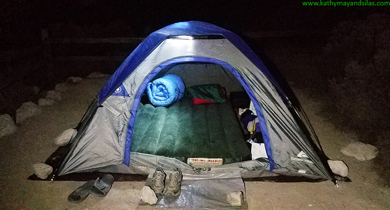
In honesty we scoffed when our friends mentioned that campers bring air mattresses to the great outdoors, but we surprisingly settled upon a camping mattress, which is just that! Our single height, full-size camping mattress is a cheap, simple option that ensured comfort over a week of sleeping on the ground, in a desert environment without soil, grass, or leaves to soften our slumber. It has a battery-operated pump for inflation in minutes.
FOOD
In case you’re wondering (we were) – no, the romantic idea of cooking over the fire is not advisable… unless you are just roasting marshmallows. It is inefficient and will burn cookware! Burying foil packets in mature coals is possible, but at the risk of carcinogens. Camp stoves are a much better idea. There are many options, with considerations of your desire for a home-cooked meal versus just boiling water, as well as factors such as portability, weight, and fuel.

- Petroleum stoves: Petroleum stoves (A) are fast and effective, even at very low temperatures; however, they may not be ideal for backpacking because of their weight and bulk. They utilize easy-to-find white gas, kerosene, jet fuel, or even gasoline that is poured into a reusable fuel canister and then pressurized by hand pump. It’s easy to see why these can be messy and dangerous!
- Liquid gas stoves: These are easy to use and efficiently utilize pressurized butane, isobutane, or propane with a clean burn; however, fuel can be expensive and canisters are not refillable. Tabletop burners (B) are analogous to gas ranges with which we’re familiar – the fuel container screws into the system. Alternatively, canister stoves (C) are great for backpacking – the stove screws directly onto the fuel container.
- Chemical solid fuel stoves: Of all the options, this is the most simple, small, and light. Many stoves are even foldable (D)! Fuel tablets, or small blocks of organic compounds (hemamine, Esbit, Triox, and more), are burned. Unfortunately, each tablet only lasts a few minutes, does not generate much heat, and can leave a brown sticky residue on cookware.
- Alcohol stoves: Alcohol stoves (E) may utilize cans that look similar to the heat element under the chafing dishes at catered events. Or, they can even be homemade from tin or aluminum cans! Though they are simple and clean-burning, they do not generate a great deal of heat.
- GORP: Especially with car camping but even with backpacking, camp stoves are not a necessity! You could always go with “good old raisins and peanuts” and other foods that don’t require cooking or refrigeration. Breads, peanut butter, canned meats and fish, cereal, bars, are some ideas. Don’t forget to stash some chocolate, candy, cookies, and cake!
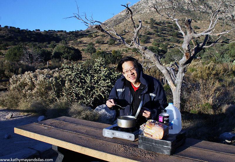
We opted for a simple tabletop butane stove with a single burner, effective for boiling water and heating foods in a small pot. Screw the canister into the stove, turn the dial, and then light!
SAFETY
- Illumination:
- A lamp with a hook is very helpful. It can be hung from the inside of the tent for illumination while you’re in it; while it’s hung the tent will glow to provide ambient light while you’re outside of it. It can also be carried with you during short walks.
- We also prioritized bright handheld flashlights with wide fields to light our way. In addition to standard sized flashlights, we also carried smaller convenient cylindrical flashlights to easily stash in our bags and pockets. We brought along a tactical flashlight, too, given to us by Kathy May’s brother Tom-Vinh.
- We found head lamps incredibly useful. Being hands-free allowed us to pitch our tent, cook food, explore caves, and go on short walks to the washroom in the darkness. They virtually obviated the need for handheld flashlights (though, once again, it was helpful to keep a mini cylindrical flashlight for convenience in case we didn’t have access to our hook lamp or head lamp. When strapped to a water jug, they also provided great ambient light similar to another lamp.
- Electricity: Our destinations were very remote, sometimes miles away from electricity and cell phone signals, and hundreds of miles away from cities. However, being the unfortunate modern creatures we are, we needed some volts to charge our electronics.
- Electronics that we brought included: Mobile phones, camera batteries, dash cam, action cam. We also brought a small netbook to transfer the thousands of pictures we take from memory cards to a portable hard drive.
- An car AC power inverter is one of the best car-related purchases we’ve made (for camping and not). It plugs into the cigarette lighter and provides DC-to-AC sockets, as well as additional USB charging ports and a 12V cigarette lighter socket. Ours is even shaped to fit into the cup holder.
- We couldn’t run our car all the time to run the AC inverter, so we brought our rechargeable high-capacity battery pack for emergency power (mostly our mobile phones). Don’t forget to put your phone in airplane mode if you’re remote with absolutely no signal to prevent unnecessary power depletion.
- You’ll need to consider alkaline versus rechargeable batteries for your lights, pumps, walkie talkies, etc.
- First-aid kit: This list seems extensive but one can tailor the supplies to his/her particular trip and pack it in a compact area. You should consider the following.
- First-aid supplies such as adhesive bandages, gauze, antiseptic topicals, antibiotic topicals, sterile wipes and rinse.
- Topicals such as hand sanitizer, soap, sunblock, sunburn relief, bug spray, sting relief.
- Medicine such as ibuprofen, acetaminophen, hydrocortisone, antihistamine, Epi pen, anti-diarrheal meds, antacids, cough drops. Don’t forget your typical prescription meds too.
- Miscellaneous supplies such as surgical gloves, tweezers, safety pins, scissors, scalpel, utility knife, duct tape.
- Campfire: Though it’s a core idea of “camping,” our desert destinations banned campfires for obvious reasons. We’ve received a good deal of advice on campfires but thus far do not have firsthand experience; we’ll update this as we try it out in the future!
Well, there you have it! That’s basically everything that we know about camping so far! We are mere novices (as suggested by the fact that we went car-camping as opposed to backpacking). Surprisingly, it can be expensive to live in the wilderness, and some equipment is costly. However, most equipment requires one-time investments only, or gadgets that we use in our everyday lives anyway, so we were able to find a budget-friendly way to be comfortable during our camping road trip! If you have any tips on frontcountry camping, please do share them below in the comments! We would appreciate more tips and learning from you!
Until next time,
Kathy May and Silas

Arrival at Mount Desert Island
Acadia National Park is located just 4-5 hours north of Boston, in the “Down East” region of Maine. The bulk of its 47 thousand acres sprawls across Mount Desert Island (the rest lies on Isle au Haut and Schoodic Peninsula). Originally named “L’île des Monts Déserts” or “Island of the Bare Mountains” by French explorer Samuel de Champlain in 1604, Mount Desert Island has a modern-day pronunciation that is under much debate. Many Maineiacs retain the French fashion of stressing the second syllable (though with a different tone) and say “de-ZERT” (dəˈzərt), much like the noun of “sweet course eaten at the end of a meal” or the verb of “to abandon, fail, or run away.” Others pronounce it according to the English pronunciation and say “DEH-zert” (ˈdezərt), much like the noun of a “dry and barren area of land”; the latter pronunciation is often used by visitors, too, purely because of the spelling. You’ll find that the border between park grounds and commercial areas are blurred, so you’ll never be too far from creature comforts while at Acadia.
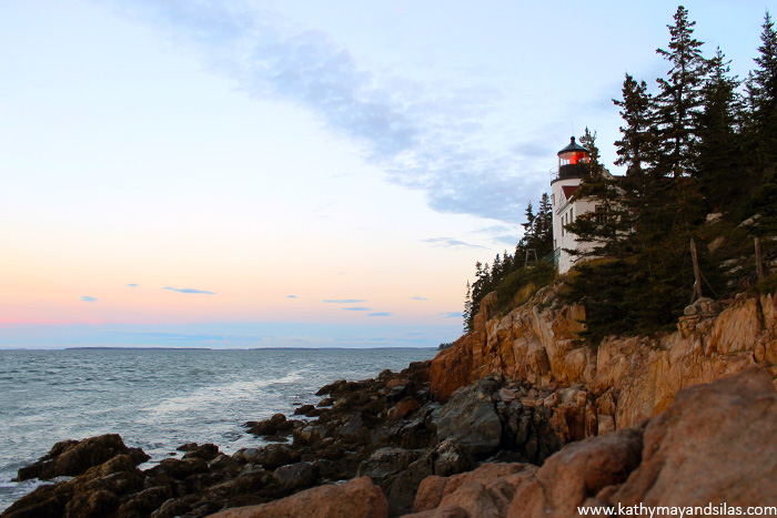
Sunrise over Bass Harbor Head Lighthouse
Ancient glaciers carved out the fjord of Somes Sound which divides Mount Desert Island into two lobes: a popular eastern side drawing over 3 million tourists a year, and a more undisturbed western side often referred to as the “quiet side” of the island. At the southern tip of the quiet side, we awoke in the wee hours and scrambled across the rocky shoreline to relish in the first morning light at the Bass Harbor Head Lighthouse. If you learned about “signature” signals of lighthouses from our Nauset Light blog post, you’ll be interested to know that Bass Harbor Head Lighthouse’s signature signal is red light occulting every four seconds (three seconds red; one second off). If you’re a photographer in search of spectacular sunrise snaps, please note that the accessible cliffs are to the east of the lighthouse; therefore, you’ll see the sun rising opposite to the lighthouse not over it. A more iconic Acadian sunrise may be Cadillac Mountain (later in this post) though you’ll have to share it with considerably more visitors than at Bass Harbor Head Lighthouse.
Ship Harbor Trail on the Quiet Side of Mount Desert Island
Also on the quiet side of MDI, we stumbled upon a fantastic 1.3 mile trail that was a real gem. The Ship Harbor Trail was a pleasant, easy, fairly level walk (even Mimi could do it; see video below) that took us through rapid changes in scenery, from roadside through pine forest, suddenly opening up into a peaceful cove of pink granite, and then to rocky coastline and the wide open blue ocean. Along the way, every section had a great deal to explore, including lush vegetation and wildlife, tide pools in the granite crevices, and panoramic vistas of trees, rocks, and water, in an intimate setting. As an alternative, you may also choose to add on the Wonderland Trail to the same trek; it is an equally easy hike of similar distance that is just half a mile east of the Ship Harbor Trail with similar views and terrain.
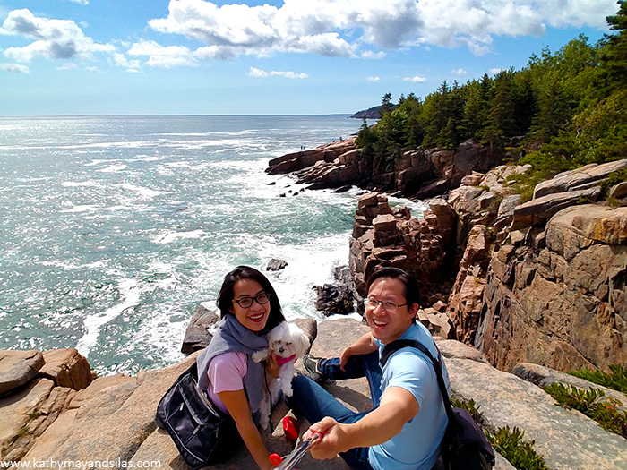
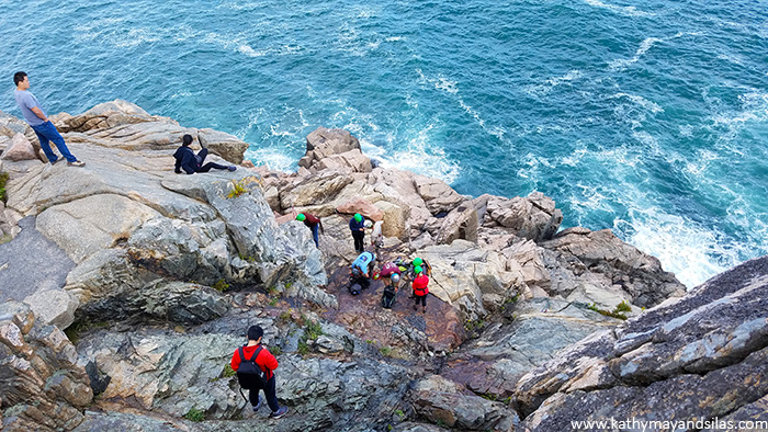
Dramatic Coastline of Ocean Path Trail Along Park Loop Road
The Park Loop Road is a one-way 27-mile drive on the east side of MDI where tourists oftentimes begin their adventures in Acadia. If you do not have a car, the National Park Service provides a free shuttle called Island Explorer which operates seasonally. Regardless, you should get out of the car and take advantage of the stunning Ocean Path, which runs alongside the eastern part of the loop. It is easy to see why Ocean Path is Acadia’s most iconic trail, as it provides a sampling of the diverse terrain of the northeast, from its playful beaches to fearsome rocky cliffs to shady forests to scenic mountains. Expect to spend a disproportionately large amount of time to cover just 2 miles of trail. You’ll find yourself exploring the nooks and crannies of the points of interest, including Sand Beach, Thunder Hole, Monument Cove, Otter Cliff, and numerous lookouts along the way.
Glacier-Carved Landscape at Jordan Pond
Jordan Pond is a tarn, or a mountain lake that is formed as a glacier melts, with exceptional visibility as deep as 60 feet! The glacier whose pristine water now fills Jordan Pond and also supplies fresh water to the village of Seal Harbor was the Wisconsin Ice Sheet from approximately 2.6 million to 11,700 years ago. Historically, Acadia was a beloved summer retreat for the likes of the Rockefellers, Vanderbilts, Morgans, Fords, Astors, and Carnegies, and Jordan Pond was the central location at which they reportedly relished the view of the North and South Bubbles, two humps of mountains with many popular hiking trails.
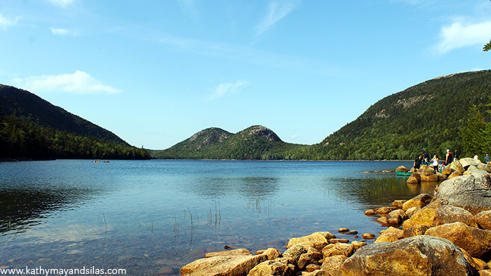
Sunset on Cadillac Mountain
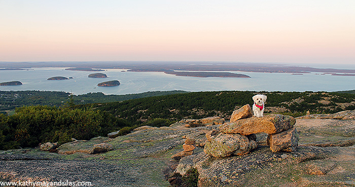
At 1,530 feet, Cadillac Mountain is not only the tallest mountain in Acadia, but also it is the tallest mountain along the American Atlantic coast (the tallest peak of all the Atlantic coast is in Rio de Janeiro, Brazil). From here, one may view the first sunrise in the continental USA (as a technicality, this only occurs because the horizon may be viewed earlier from the elevation of Cadillac Mountain; the easternmost point in the continental USA to view the first sunrise is in Lubec, Maine; if you want to get more technical, then it’s at Semisopochnoi Island, Alaska, which is west of the 180-degree meridian). Alas we did not see the sun rising over Cadillac Mountain, but we did enjoy the 360-degree panoramic vistas from the summit at sunset. The mountain itself is fascinating, formed by upward forces of volcanic and tectonic plates colliding, then sheared by monstrous glaciers, leaving behind deep gouges in pink granite and a rounded peak. Note that this location in Acadia is incredibly popular and budget more time than expected to travel and find parking along the 3.5-mile Summit Road. If you are not traveling by car, know that the free shuttle buses stop at the North Ridge Trail but do not go to the top of Cadillac Mountain. From that trail head, you can either hike or take one of two private buses with narrated tours.
All in all, we had a splendid adventure at Acadia National Park and we look forward to experiencing it during different seasons in the future! Please stay tuned to our blog as we visit other national parks, monuments, historical sites, and more. Our past leaders have compassionately led the protection and preservation of treasures within the National Parks Service and, with current events, we are saddened that many of these sites are now at risk. We’ll leave you with a quote by President Franklin D. Roosevelt in hopes that you’ll support the National Parks Service and what they mean to our country:
“There is nothing so American as our national parks…. The fundamental idea behind the parks…is that the country belongs to the people.”
Until next time,
Kathy May and Silas

References:
National Parks Service
Acadia Magic by Greg Hartford
Joe’s Guide to Acadia National Park
]]>
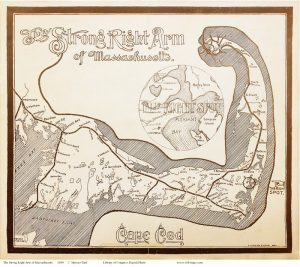
On a crisp May day, we and our good friends, Matt and Jocelyn, made a trek down to Cape Cod, or “the Cape,” as native Massachusettsans call it. In the tradition of the great American essayist Thoreau, the Cape is frequently described as an arm extending from the southeast corner of Massachusetts:
“Cape Cod is the bared and bended arm of Massachusetts. The shoulder is at Buzzard’s Bay; the elbow at Cape Mallebarre; the wrist at Truro; and the sandy fist at Provincetown.”
-Henry David Thoreau
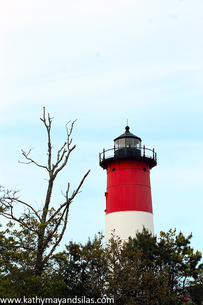
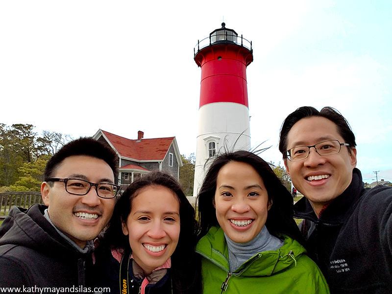
Our final stop was in the forearm of the Cape where, much to our surprise and delight, we came across a vaguely familiar red and white lighthouse! Do you recognize this national icon?
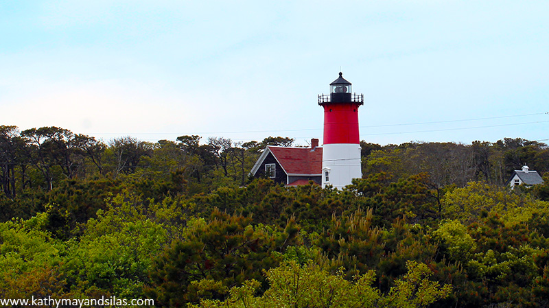
Yes! It’s the lighthouse featured on the bags of Cape Cod Potato Chips, the kettle-cooked American goodness that is made in Hyannis, right there on the Cape! If you are interested, please investigate Cape Code Potato Chip’s factory tour. We haven’t been ourselves but let us know if it’s worth a gander! We also spot the lighthouse every now and then on specialty Massachusetts license plates.

It’s called Nauset Light, and it’s one of the beautiful landmarks of the Northeast and of seafaring world in general. Since the first lighthouse, Pharos in the ancient city of Alexandria, lighthouses have provided warm lights to guide mariners through treacherous waters and acted as welcoming beacons to call travelers home. It’s no wonder that lighthouses have become a romantic symbol in our culture – a comforting brilliance in a lonely and dark world.
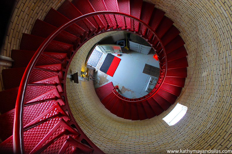
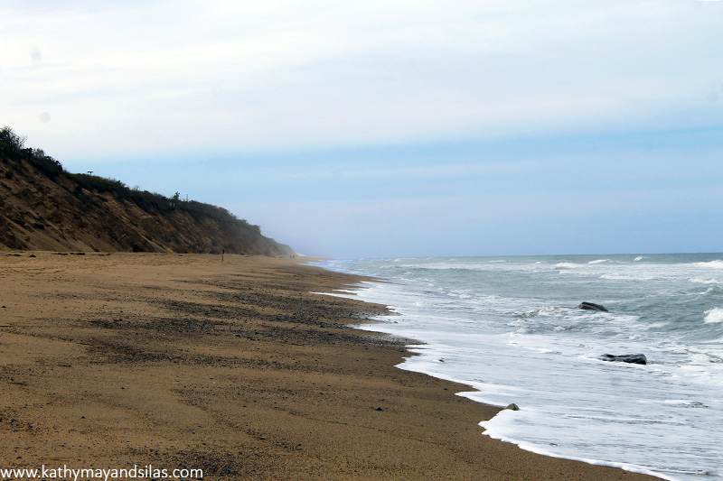
Nauset Light is actually one of a set of twins originally built in Chatham in 1877. The southern twin is still there today; the northern Nauset Light was moved to Eastham, where it replaced the beacon of the final of the Three Sisters, a bit more inland from the encroaching cliff edge. Through the years, the dangerously eroding seashore necessitated another move of Nauset Light, and in the future, another relocation will be required to prevent it from falling into the ocean. The Cape Cod coastline erodes at an astounding rate of approximately 3 to 6 feet per year, at worst 15 feet per year! With the combination of rising sea water level and natural erosion, there will come a time where Cape Cod will be no more! By the way, the Three Sisters Lighthouses, named so because from the sea they looked like ladies in white dresses with black hats, have quite a colorful and circuitous history. You can visit them on display, well away from the shore, within walking distance of Nauset Light, also on the Cape Cod National Seashore.
Every lighthouse has a “signature,” a set of characteristics so that mariners may identify land and location. Nauset Light’s two rotating aero beacons shine alternating red and white flashes with 5 second intervals between them. In the 1940s it was painted its distinctive red and white as a daytime indicator.
Being the emblem of Cape Cod potato chips makes Nauset Light memorable, but we look forward to visiting the 15 other spectacular lighthouses on Cape Cod. Are there any you recommend? Please let us know!
Until next time,
Kathy May and Silas
Resources:
National Park Service: Cape Cod National Seashore Lighthouses
Nauset Lighthouse Preservation Society
 Just because we moved out of NYC doesn’t mean that we would miss one of our favorite events of the year: World Maker Faire! How do we explain Maker Faire? It’s an exhibition, festival, and celebration of technology, crafts, engineering, robotics, and everything DIY. It’s a gathering of inventors, tinkerers, scientists, artists, builders – all of whom are makers in their own domain. Held at the New York Hall of Science, the World Maker Faire is the largest of the international series; October 1-2, 2016 was the 7th annual event.
This year, we were thrilled to explore Maker Faire with Jon, Lily, and Jen! We chatted with creative minds of all ages and sizes and types. We learned about the latest machines, gadgets, and doodads. We heard about projects that others are pursuing and picked up ideas and tips for our own. We even made some things right then and there during the faire. Most of all, we had lots of fun!
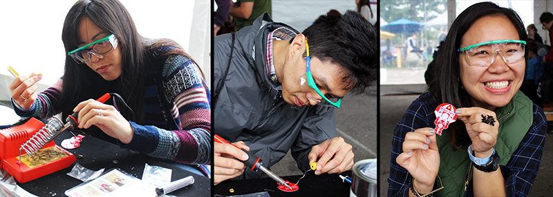
This is the first year we’ve participated in one of the most popular Maker Faire activities: learning to solder. Donned with Google safety glasses, we soldered a battery holder, pin, and LED to a printed circuit board in the shape of the Makey Robot. So easy and fun!
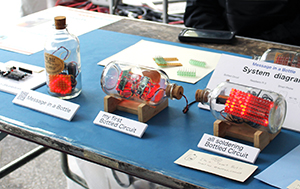 In the Maker Shed, we saw a vast array of innovative projects. One of our favorites was the circuits-in-a-bottle project by Kimio Kosaka. Incredibly, all the parts are soldered together inside the bottle. Unfortunately, this picture does not do this creative project justice! We were too busy marveling and asking questions. See more details on Kimio’s DIY video!
Maker projects spanned from fun at-home endeavors to commercial ventures. For example, we loved the MATRIX Creator, which is basically a Raspberry Pi add-on pre-built with a number of sensors and microcontrollers, powered by a proprietary (secret algorithm) operating system. Its capabilities are endless and clearly largely unexplored! Watch our video below to see one potential functionality: Face detection, tracking, and interpretation (also featured: our silly facial expressions :-P).

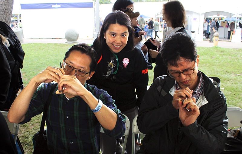
We tried our hand at single-pin lock picking. The instructions are much more easily explained than executed. Of our group, only Lily was successful! Here she is “supervising” Silas and Jon sweating away, hard at work.
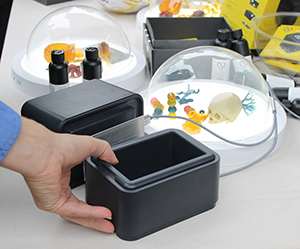 Years ago, at our first Maker Faire, we saw our first 3D printer. In a shockingly short amount of time, after decades of utility in industrial fabrication, these have now become mainstream. The MakerBot Replicator and even Formlabs Forms are old news and companies are now striving to distinguish themselves. Nowadays, you can 3D print plastics, metals, clay, rubber, even chocolates. We saw many examples of great efforts: printers which used plastic waste instead of filament or resin, others which printed and mixed different colored plastic, etc. We were most impressed by the ONO, the first-ever smartphone 3D printer which raised over $1 million on Kickstarter in just 5 days! A tray filled with DLP resin sits over the smartphone. This resin hardens with exposure to normal visible light. An app displays patterns on the screen to harden the resin while a moving platform pulls the hardened resin up so that the next layer can be printed. It should be available in the U.S. soon!
Check out this Knitting Printer, an awesome invention brought to us by Asbjørn Rørvik and Fredrik Fjellså from Norway! We were entranced by the process. So far it looks like its functionality is limited to making tubes – socks, scarves, and Dachshund sweaters… but who can have enough of those?! By the way, the component parts of these automated knitting machine were 3D printed, too!
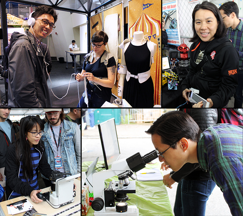
Here are some other pictures of our highlights during the day!
1. Jon listening to knitting. Teresa Lamb wears a harness and arm-piece which translates the movements of knitting into sound.
2. Lily jamming out on a ukelele programmed with Arduino.
3. Kathy May operating Shaper Origin, the world’s first handheld CNC machine. It’s totally portable and self-guiding!
4. Silas examining water bears AKA tardigrades (indestructible micro-animals that can survive in outer space) under the microscope.
Check out our gallery for more Maker Faire pictures that we couldn’t fit into the body of this post!
[See image gallery at www.kathymayandsilas.com]Until next time,
Kathy May and Silas
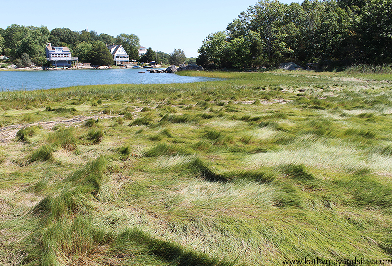
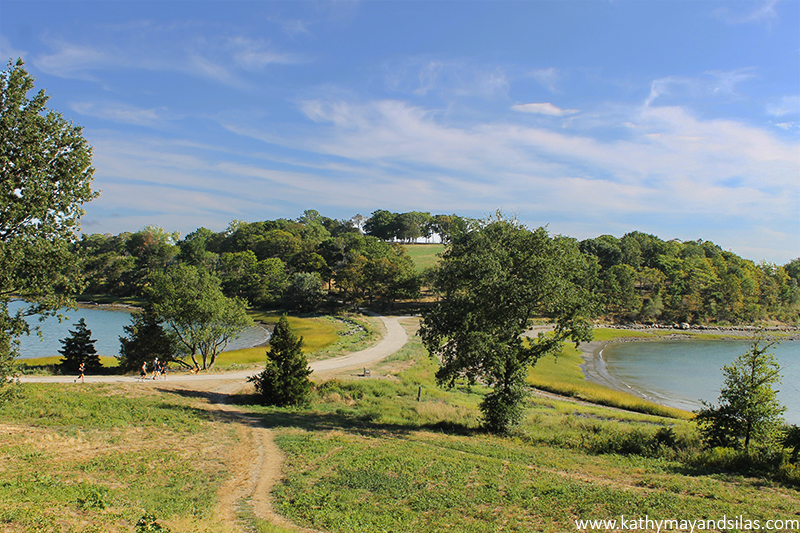
Boston Harbor Islands NRA is a system of drumlin islands (34 to be exact). A drumlin, etymologically derived from the Irish word droimnín meaning “littlest ridge,” is a small oval hill that is formed by the slow excavation of land by glaciers. As seawater level increased, only the top of these drumlins remain as dry land and have become the Boston Harbor Islands. World’s End is actually no longer an island at all. It used to be one, at high tide, until colonists dammed the salt marsh with agricultural ambitions. In the late 19th century, it was slated to become a farming estate, with Frederick Law Olmsted, America’s legendary landscape architect who designed our beloved Central Park in Manhattan, Prospect Park in Brooklyn, and Golden Gate Park in San Fran, hired to be the mastermind behind the grandest subdivision. Unfortunately (or fortunately, for us), the homes were never built and the four miles of carriage roads that remain have become today’s hiking trails at World’s End. Though World’s End is now a peninsula, four drumlins still remain as landlocked hills. Here is the view from one drumlin towards another. On the left is Weir River; on the right is Hingham Harbor.
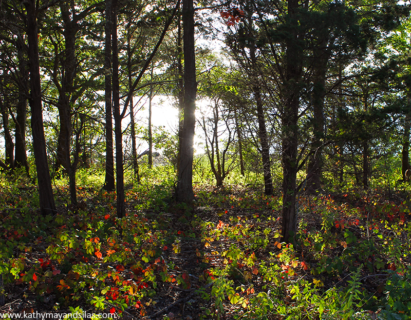
Fun fact: World’s End was one of the few locations considered for the site of the United Nations headquarters. As we know, the site finally selected was the east side of Manhattan. Can you imagine the General Assembly meeting in this mystical forest upon this ground-cover of stained glass leaves?
The diversity of landscapes (meadows, tree groves, rocky shores, salt- and freshwater marshes, and more) of World’s End are occupied by a diversity of wildlife. For example, we spotted a flock of more than a dozen wild turkeys (note that it was a flock, not a rafter or gang, which would imply their members were turkeys of the domesticated kind). They trotted single-file from the marsh, across the trail, to the forest. Later on a drumlintop, we found a gigantic turkey feather.

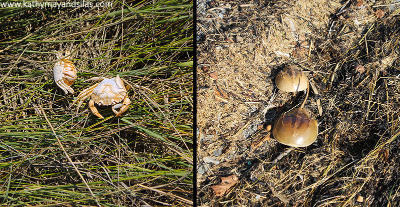
Summer is crab molting season and we managed to just catch the end of it. On the left are a couple of the molts that we found suspended in the sinewy tips of saltwater marsh grass. We are not sure the species as their colors have been bleached by the sun. Their size and shape are very similar to our former pet crabs. We believe those were Japanese shore crabs (click here to learn about how we raised our pet crabs). As physicians, we are great fans of horseshoe crabs, and we saw a number of their molts littering the rocky shoreline (by the way, stay tuned to our blog to learn more about why we love horseshoe crabs, how their mating and molting works, and what we will create with these empty shells)!
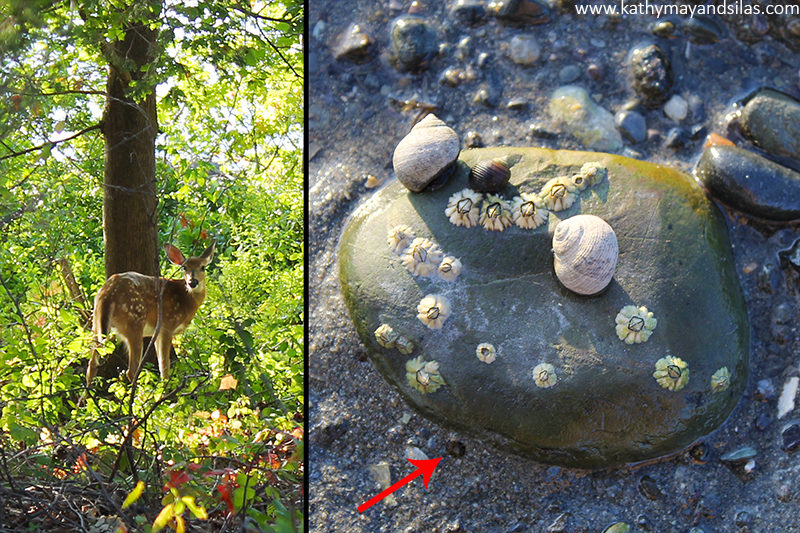
As we peered beyond the blueberry thickets into the forest, we spotted a prancing deer. It was quite large though still had the white dappled camouflage markings of a fawn and there was no mother in sight. As we explored the sea floor at low tide, we were frequently squirted by water. We soon realized that these squirts of water, which reached at least a meter into the air, arose from little holes in the wet sand (red arrow below). We still have to do some research into exactly what were the concealed creatures doing this – perhaps a buried clam? If you know, please let us know in the comments below!
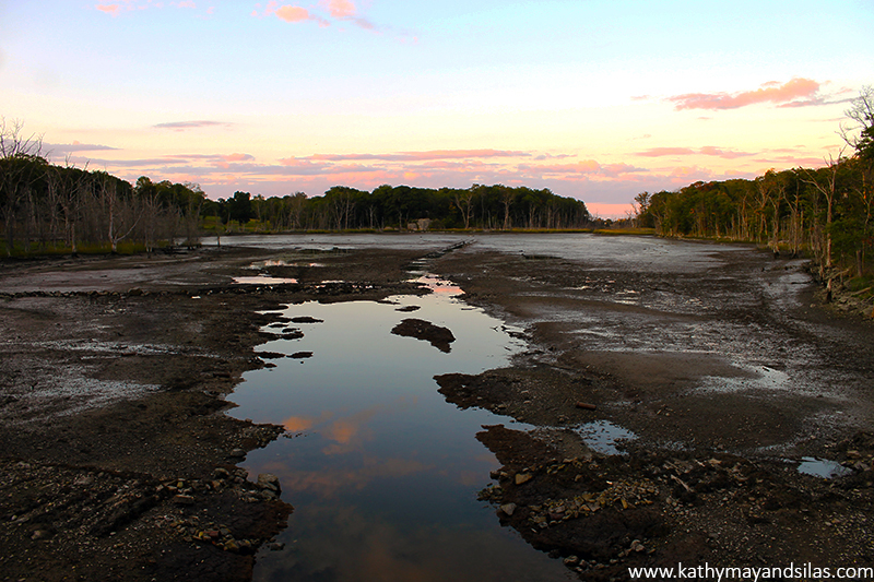
What a wonderfully magical site this was. We concluded our wonderful expedition to the world’s end at dusk by overlooking the salt marsh, essentially emptied by the outgoing tide.
What a wonderfully magical site World’s End is. Click here to see a two-minute drone eye’s view of World’s End that really showcases its exquisite beauty.
Until next time,
Kathy May and Silas

References:
http://www.thetrustees.org/places-to-visit/south-shore/worlds-end.html
http://science.nature.nps.gov/im/units/netn/parkPages/BOHA.cfm
http://www.bostonharborislands.org/worlds-end
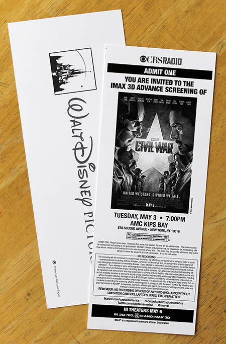 Advance screenings are promotions for new films, a studio’s marketing strategy to generate word-of-mouth advertising and build hype. I learned that, at the screening from last night, a large number of tickets were awarded through contests (radio, sweepstakes, etc); others were presented to loyal fans of Marvel, Walt Disney, or movies in general; still others were distributed by street promo teams similar to the ones we often see here in bustling New York; and, finally, some were given to critics and press. The advance screening was shown in IMAX 3D at AMC; my ticket was sponsored by Walt Disney Pictures and CBS Radio.
Captain America: Civil War is the 13th and the newest feature film of the Marvel Cinematic Universe. The Universe itself is an absolute genius multimedia business approach, a corporate innovation, and the brainchild of the Marvel Studios president, Kevin Feige. Of course, like other traditional movies, Marvel’s feature films spawn a marketing campaign including merchandising and sequels. However, what is spectacular about Marvel’s economic strategy is that the films also serve as an anchor for what has become a colossal commercial endeavor that is much, much more. Marvel has created an elaborate web, world, and – indeed – universe that intertwines characters, settings, story lines, all of which allow the exponential expansion of the franchise into comic books, short films, attractions, commercials, etc. For example, the feature films feed and are fed by major TV shows including Agents of S.H.I.E.L.D. on ABC, Daredevil on Netflix, and others. In terms of business, the interweaving of characters and story lines means automatic cross-promotion for the different elements of the Marvel franchise. In terms of fandom, the crossover paves the way for elaborate plots and complex personas that are constantly developing; exciting anticipation for the revelation of new characters and events; and overall good entertainment. Marvel’s megafranchise is now the leading giant of entertainment, setting the cinematic standard which other companies are trying to achieve, albeit somewhat less successfully (read: X-Men). It’s become known as “the Avengers effect.” I’m certain that Marvel’s impressive storytelling and marketing strategies are an important contributor of the impossible – making geek and nerd culture mainstream. All of a sudden, it is cool to like superheroes! By the way, a couple of years ago, Bloomberg Businessweek published a fascinating chronicle on how Marvel started out as an underdog and is now is a multimedia behemoth (read it here).
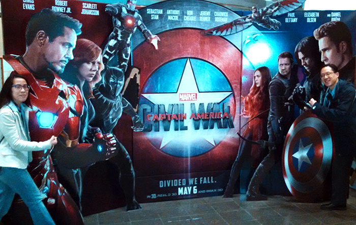
True to its reputation of interlocking, the highly anticipated Captain America 3 touts a cast list of giants – both in terms of the fictional comic book personalities and the real-life movie stars who play them. There was the return of our favorite characters already established in the Marvel Cinematic Universe: Steve Rogers AKA Captain America (Chris Evans), Tony Stark AKA Iron Man (Robert Downey, Jr), Sam Wilson AKA Falcon (Anthony Mackie), Bucky Barnes AKA the Winter Soldier (Sebastian Stan), Natasha Romanoff AKA Black Widow (Scarlett Johansson), Wanda Maximoff AKA Scarlet Witch (Elizabeth Olsen), Vision (Paul Bettany), James “Rhodey” Rhodes AKA War Machine (Don Cheadle), Clint Barton AKA Hawkeye (Jeremy Renner), Scott Lang AKA Ant Man (Paul Rudd), and Sharon Carter (Emily VanCamp). There were also exciting introductions of personalities known to old-school Marvel comic book lovers but not to the modern Marvel big screen: T’Challa AKA Black Panther (Chadwick Boseman) and – perhaps one of the most highly anticipated characters to enter the Universe – Peter Parker AKA Spider-Man (Tom Holland)!
Speaking of highly anticipated introductions in Captain America 3, the incorporation of Spider-Man into the Marvel Cinematic Universe is an interesting agreement between Sony and Marvel. Spider-Man is possibly the most iconic superhuman created by Stan Lee and it seems unusual that one of the most beloved Marvel characters is absent from story lines; however, Marvel could not incorporate Spider-Man into the Universe because it sold the rights to Sony way back before multimedia megafranchises were a thing. That is, until now. After less than impressive performances of Spider-Man movies, Sony has decided to reboot the character. The way they are choosing to do so is to ride on the fandom and following of Marvel Studios. For a grand total of zero dollars, Marvel Studios can use Spider-Man in their films, satiating fans by giving them one of their biggest superheroes. In return, Sony will build their own standalone Spider-Man franchise upon the rehabilitated character personality introduced in those Marvel films. As Sony retains all rights, it will benefit from the solo Spider-Man features which are set to begin in 2017. Surprisingly, I did not feel that Spider-Man’s inclusion in Captain America 3 was contrived, and his appearance fit well in the plot. However, the new Spider-Man is a teenager… blah. Spider-Man is one of my favorites and I like idea of a Peter Parker who, similarly to other young adults finding their way, is constantly striving to establish an identify for himself – in school, work, family, romance, and in his immensely complicated superhuman role. The rebooted Spider-Man is also intended to be relatable but now it is to a younger audience with growing pain challenges – none of that appeals to me individually (read: I think I’m getting old). Even though I’m not an immediate fan of the new Spidey, it will be interesting to see how Sony (and Marvel) develops the character. In this Marvel film, Peter films Spidey and uploads the videos to YouTube, rather than photographing him for publication in J. Jonah Jameson’s Daily Bugle (really?!).
I’ve never attended an advance screening but if I had a choice for what would be my first, it would indeed have been Captain America: Civil War! Even with the laundry list of characters, the plot was forward-moving and each individual played an important role. I would expect nothing less from Marvel than the excitement, action, and great visuals provided. The story line was straightforward enough for a standalone to be enjoyed by a first-time Marvel viewer; it was complex enough for development to appease the loyal fan. I highly recommend it!
Until next time,
Kathy May
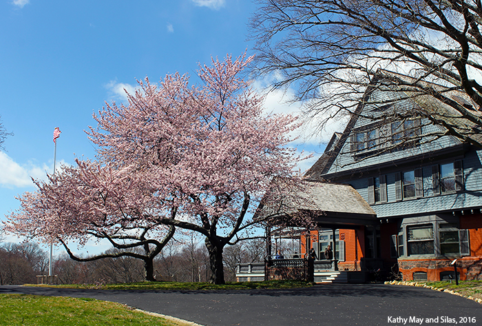
When it was time for TR, a native of Manhattan, and his wife, Alice, to build a family, they chose Oyster Bay because of TR’s fond childhood vacation memories there. Tragically, Alice died of complications related to childbirth before the Queen Anne-styled home was complete. However, TR continued construction for his new daughter, named Alice after her mom. Originally named “Leeholm” after his wife, TR decided to incorporate Sagamore, the Algonquin word for chieftain, into the title of his iconic estate. TR, his second wife (Edith), and his six children lived in the 23-roomed mansion before and after his presidency. It became known as the “Summer White House” because TR hosted prominent national and global figures there during his seven summers of presidency.
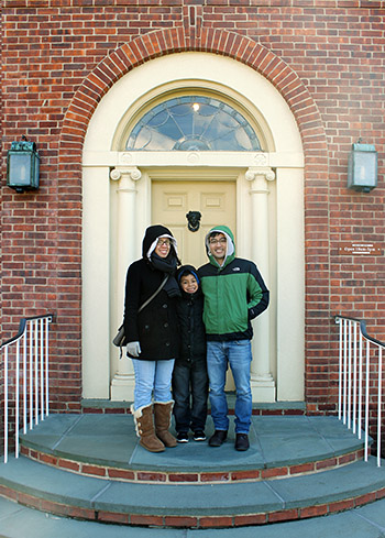 As an aside, don’t confuse the “Summer White House” with the “Little White House,” which belonged to the other President Roosevelt (Franklin Delano, 32nd POTUS) in Kathy’s home state of Georgia. TR and FDR are fifth cousins in the Roosevelt family, a powerful business and political dynasty. While TR was on the Oyster Bay branch of the family, FDR was a member of the Hyde Park branch. Interestingly, FDR’s wife, Eleanor, was the favorite niece of TR (making FDR and his wife fifth cousins, once removed). During his presidency, TR gave away Eleanor at her wedding. At the reception, TR said, “It is a good thing to keep the name in the family.” Family did not define politics, however, as TR was a Republican while FDR was a Democrat. Despite their differences, the beginning of FDR’s political career can be attributed to TR. When he first ran for senate, FDR was chosen by his local party as a “paper candidate” because his Republican cousin TR was still very prominent in American politics, and having a Democratic Roosevelt was good publicity. By the way, even though he was the underdog, FDR won.
We also visited the Theodore Roosevelt Museum which is located on the grounds of Sagamore Hill. It is housed in Old Orchard, the home of Brigadier General Theodore Roosevelt, III (known as Ted, Jr.), TR and Edith’s eldest son and winner of the Medal of Honor. At the museum, Yuri decided to take on the Junior Ranger challenge, the Theodore Roosevelt History Hunt. He was given an Activity Booklet by the National Park Service Park Ranger and then, as a history-detective, he searched for answers to questions about TR and his life. During the challenge, Yuri learned all about the bigger-than-life TR. Here Yuri is recording his data.
 Hugely popular during his time, TR was a charismatic man who exuded energy, athleticism, and power in his cowboy persona. Even though he was a little gun-happy in his efforts to hunt big game before they disappeared, TR also put great efforts into conservationism, preserving hundreds of thousands of acres of national land for future generations. Sometimes he supported war (posthumously won the Medal of Honor for his fighting with the Rough Riders in the Spanish-American War) and sometimes he kept peace (won the Nobel Peace Prize for negotiating the end of the Russo-Japanese War). He is remembered for his domestic policy (“Square Deal” that controlled corporations and protected consumers); his foreign policy (“Speak softly and carry a big stick,” a West African proverb); and his overall tenacity (delivered a 90-minute speech after being shot into the chest, saying “It takes more than that to kill a bull moose.”).
After answering every single question, Yuri returned his completed Activity Booklet to the Park Ranger, who scored the answers. The Park Ranger presented him with an authentic Sagamore Hill Junior Ranger Badge and an official Junior Ranger Certificate. We were so proud of Yuri’s hard work! Here is a picture of him displaying his prizes and another picture of him celebrating alongside Jocelyn, Matt, and the bust of TR himself.

Did you know that teddy bears are named after TR? During a hunting trip in Mississippi, all members of the party except for TR had found bears. You can’t invite the President of the United States on a hunting trip and have him fail, however, so the guides trapped a bear, tied it to a tree, and called for TR to shoot it. TR refused to shoot the defenseless bear because that would be unsportsmanlike (though, technically, the bear still died because TR ordered it be put down to end its pain and suffering). Word of the incident reached the public and soon, a Brooklyn candy shop owner and his wife put two handmade bears in the window with the label “Teddy’s bears.” The teddy bear was born. This bit of TR’s legacy is ironic because he had open disdain for the nickname “Teddy” (actually, his family called him “Teedie” instead), but it stuck because the general American public adored it.
The fun facts about one of the most influential leaders of our country and one of the most genuinely intriguing men in history can go on and on… but we should probably stop here for now.
Until next time,
– Kathy May and Silas
P.S. Among the other great places we visited on our Long Island tour, we saw a very big duck on the side of the road. See our adventure with The Big Duck of Flanders by clicking here.
Learn more about Sagamore Hill and Theodore Roosevelt at:
The National Park Service
The History Channel
The History Channel
Theodore Roosevelt Association
]]>
We stopped by The Big Duck during our exploration of Long Island with Jocelyn, Matt, and Yuri. It’s reminiscent of other wacky roadside attractions we’ve seen previously, such as Lucy the Elephant near Atlantic City. In the 1930s as automobile travel increased, novelty architecture such as these became widespread in attempts to draw motorists and tourists. Specifically, mimic architecture was popular: Structures were built in the shape of the product being sold to attract potential customers. Unfortunately, only a few of the whimsical buildings from that era of American history have been preserved. Now, they’re mostly oddities and tourist attractions.
At the peak of the novelty architecture movement, farmers Martin and Jeule Maurer built The Big Duck on Main Street of Riverhead in 1931. Later, it was moved four miles to Flanders, then somewhere else, then back to its spot in Flanders. It’s a ferrocement building, which means that it is made of thin-walled concrete applied over wire mesh, held up by a wooden frame about 15ft wide x 30ft long x 20ft tall. It was modeled after the Maurers’ product, the American Pekin (not Peking) duck, complete with Ford Model T tail lights for eyes that glow red at night!
In Flanders, The Big Duck in its prime location watched over the booming Long Island industry of duck farming, which included the Maurers’ own duck ranch, very unoriginally entitled The Big Duck Ranch. Ducks, duck eggs, and other duck products were sold out of the colossal duck until the mid-1980s. Even when the business inside became defunct, the residents of Flanders rallied to preserve the quirky structure as a landmark. As of 1997, The Big Duck is listed on the National Register of Historic Places (The Big Duck Rank is also listed, but separately). Today it is open to the public as a gift shop and tourist information center for the Long Island Convention and Visitors Bureau… which brings us back to our visit!
The entrance to The Big Duck was at its chest under its bill. The inside is a cozy 3.5m x 4.5m and is stocked with duck memorabilia of all kinds. Here are Matt and Silas modeling some of them.
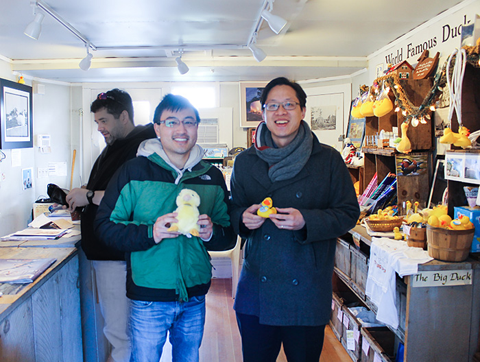
As aforementioned, this area of Suffolk County was previously teeming with duck farms. However, we learned from the gentleman manning The Big Duck that duck farms are incredibly stinky and residents became wary of potential environmental hazards that come with them. That in combination with other financial and societal factors contributed to the plummeting numbers of duck farms from their peak in the 1960s. FYI there’s supposedly only one left in the area. Here’s what’s left of The Big Duck Ranch today…
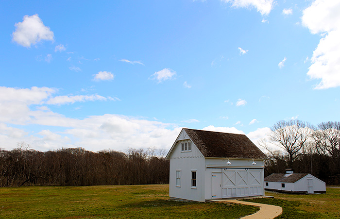
If you’re ever on Route 24 in Flanders, make sure to stop by!
Kathy May and Silas
P.S. We saw and did lots of great things on our exploration of Long Island – Montauk, classic apple pies, and even a bite-sized lesson in American history. Read about our visit to Sagamore Hill (and Teddy Roosevelt) by clicking here.
Learn more about The Big Duck at:
Suffolk County Government
Roadside America
About Travel: Long Island
